Property owners within the floodplain may need to secure flood insurance.
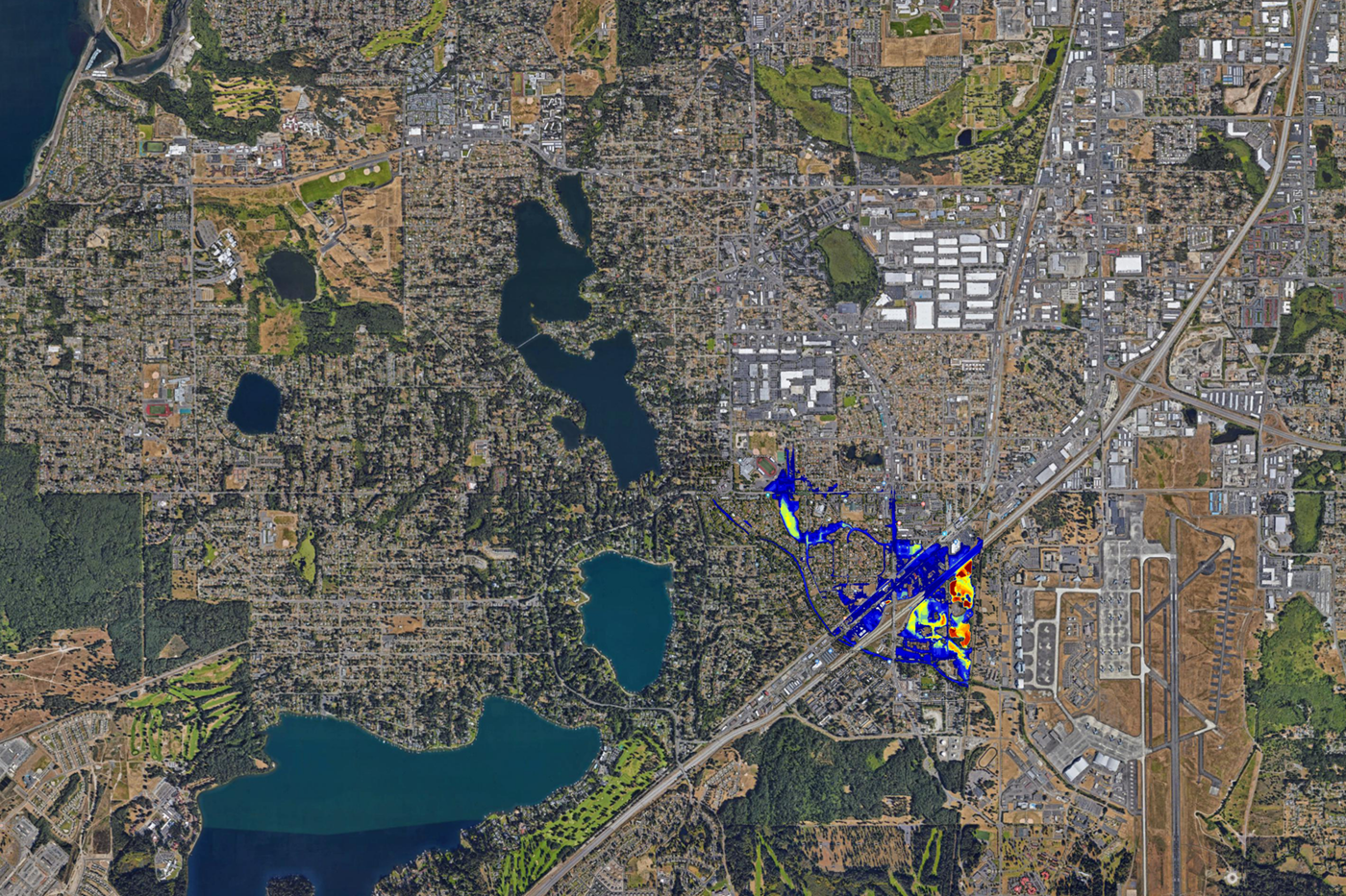
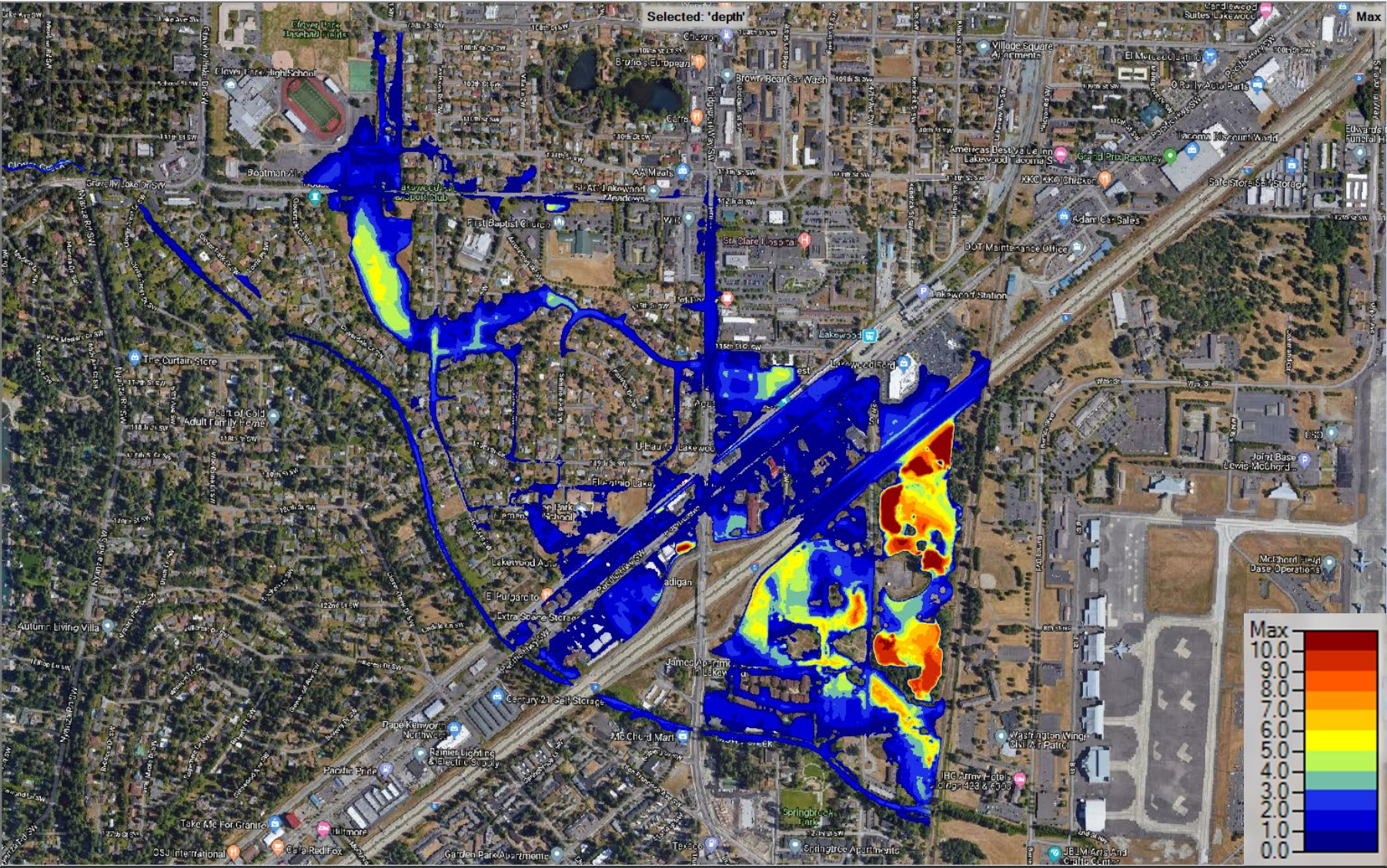
In the event of a 100-year flood, floodwater from Clover Creek may reach properties in Lakewood’s Springbrook and Hillside neighborhoods. Flooding might also compromise I-5 just north of the Bridgeport exit.
There is a mix of commercial and residential properties within the floodplain. While there is a low immediate risk, property owners within the floodplain may need to secure flood insurance.
The City will contact residents and businesses within the floodplain by mail. The City will also post updates through social media and its weekly email newsletter.
The City is researching engineering solutions to prevent flooding. Upstream from Lakewood, Clover Creek wanders through Frederickson, Parkland, and Spanaway. The City is organizing a multi-agency technical advisory group to produce solutions.
The City invites questions and comments. Visit the City’s Clover Creek Floodplain webpage and comment through the form at the bottom of the page.
| Additional Information |
| Clover Creek Floodplain Project Page City of Lakewood Weekly Email Newsletter Signup |