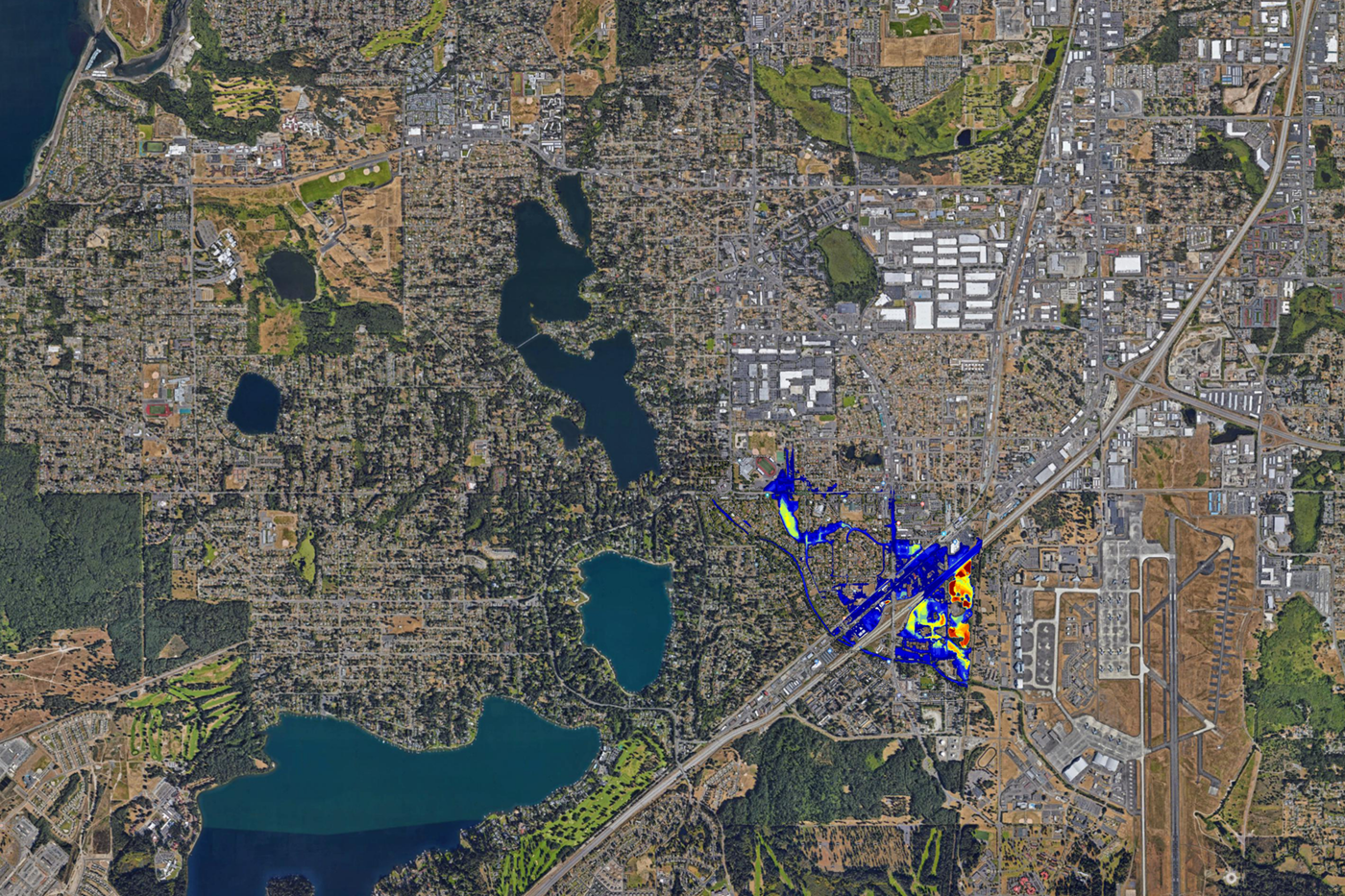
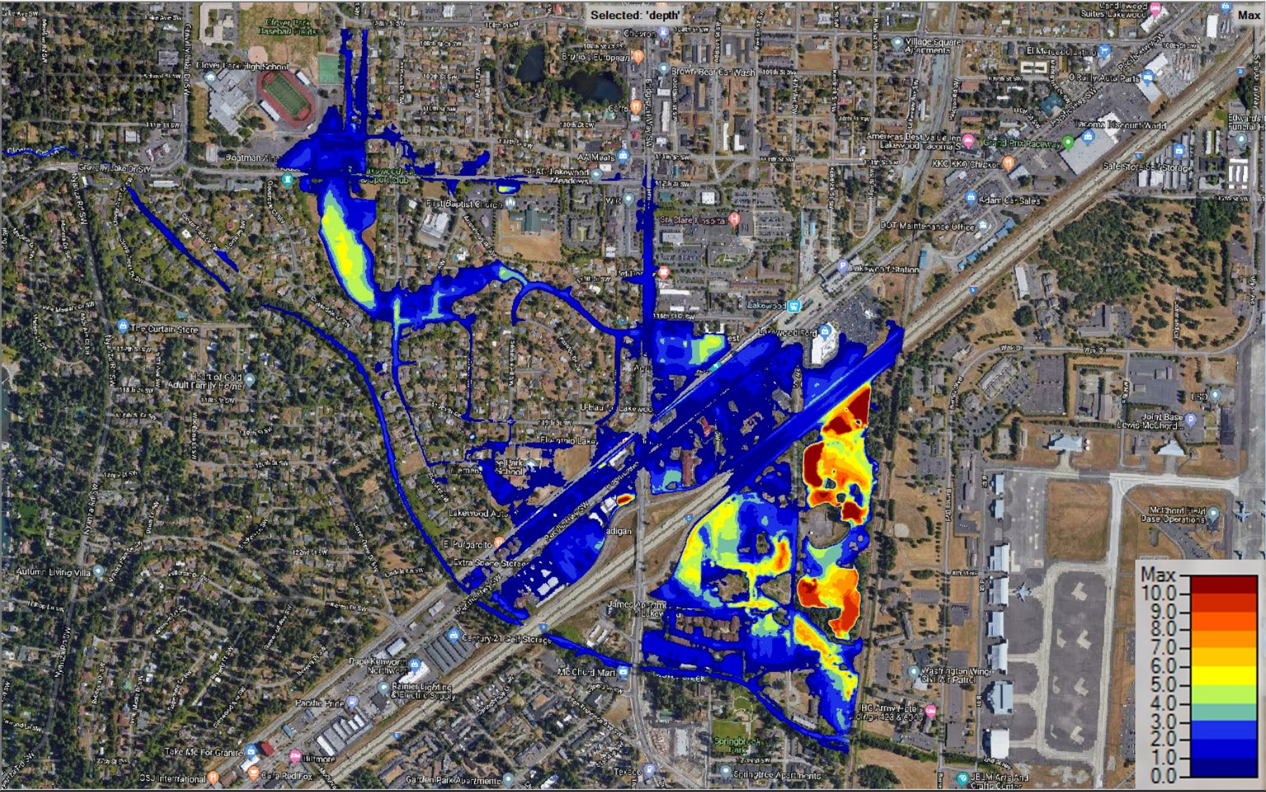
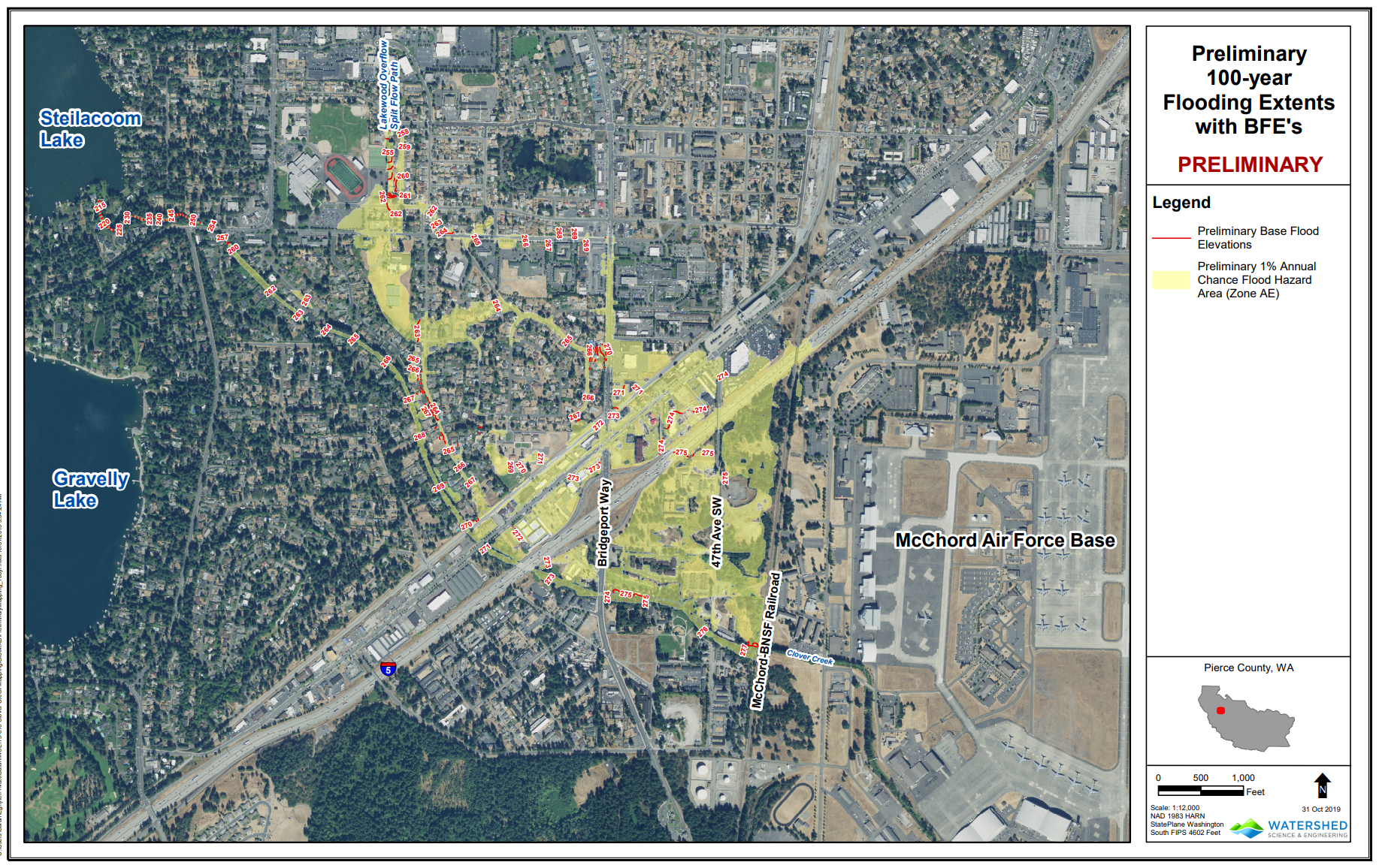
New flood maps indicate a 1% annual risk of flooding in the Springbrook and Hillside neighborhoods. During a major flood, water from Clover Creek would inundate homes, businesses, and I-5 just north of Bridgeport Way.
The City has begun to inform residents and businesses of this risk. Properties within the floodplain may eventually be required to purchase flood insurance.
Summary and Full Report
A major flood would damage property and infrastructure within the mapped floodplain. Floodwaters would affect the Springbrook neighborhood, I-5, and areas within the Hillside and Downtown neighborhoods.
There is a mix of commercial and residential properties within the floodplain. Some affected property owners may need to secure flood insurance.
While there is a low immediate risk, the City is proactively contacting affected properties and researching engineering solutions due to the impact of this flooding. A 100-year floodplain means there is roughly a 1% chance of a major flood in a given year that would affect the mapped area.
Upstream from Lakewood, Clover Creek wanders through Frederickson, Parkland, and Spanaway. The City is organizing a multi-agency technical advisory group to produce solutions.
I-5 closures are devastating for the entire region, let alone Lakewood. No convenient detour exists. A 2017 train derailment closed the highway for days, and detours extended travel times by several hours. Recent flooding in Lewis County also briefly closed the highway and threatened to halt travel for a weekend – mercifully, the flood subsided quickly.
The City will begin to contact residents and businesses within the floodplain by mailing owners and tenants of affected properties. The City will also share updates through social media and our email newsletter.
Updates
The Clover Creek Flood Study is finished. Read the full report (PDF)
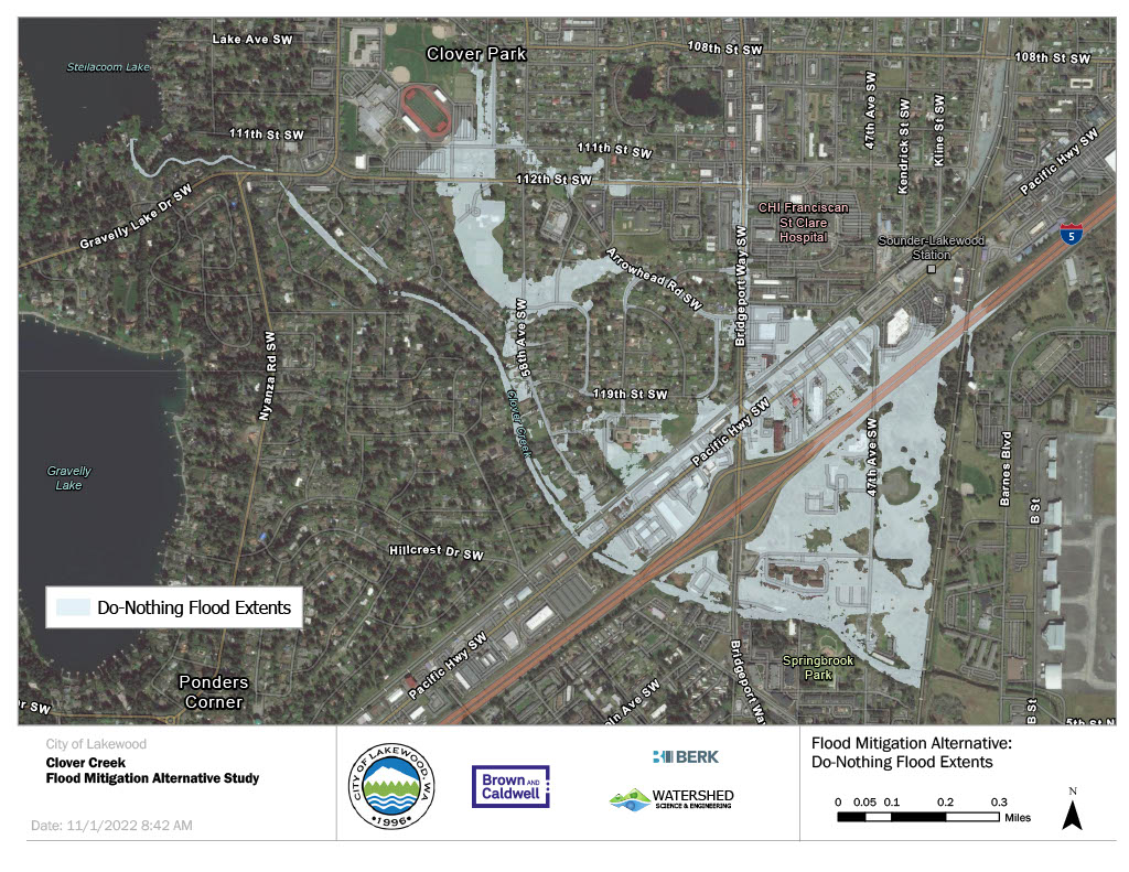
An open house is scheduled for the public to hear four alternatives the city of Lakewood is considering to resolve the issue of flooding along Clover Creek, should a 100-year flood event occur. The meeting is Thursday, Nov. 10, 2022 from 7-8:30 p.m. at Lakewood City Hall, 6000 Main Street SW.
Residents are invited to attend to review and provide feedback on the four alternatives, hear an outline for potential funding options and engage with city staff to ask questions and provide comments on the proposals. This feedback is an integral part of the city’s decision-making process when determining which alternative to pursue.
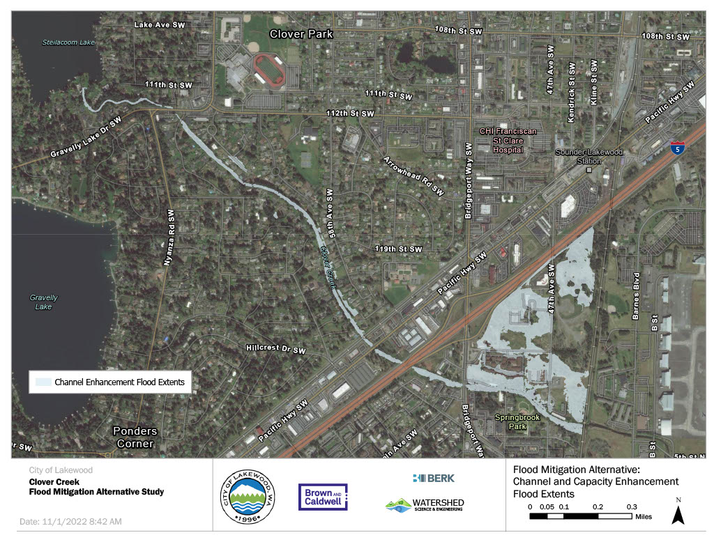
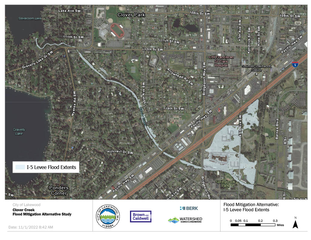
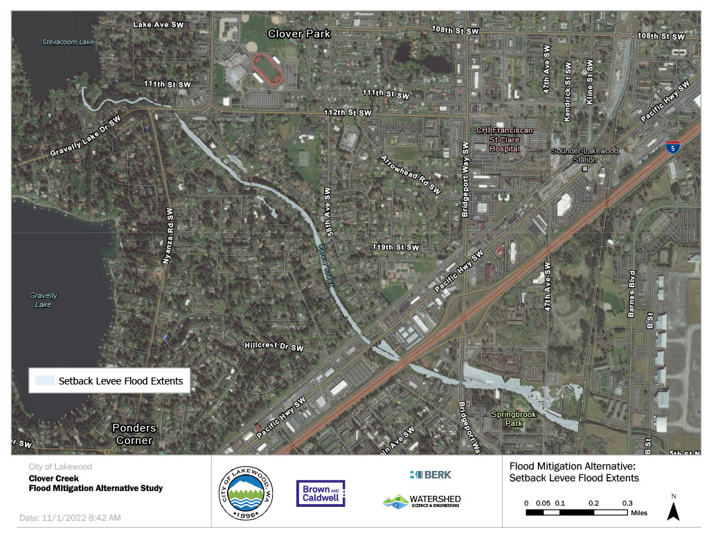
The proposed alternatives are shown below.
Timeline

Maps